what3words Ltd
Addressing & geocoding System


2018
London, UK
3wordPhoto App
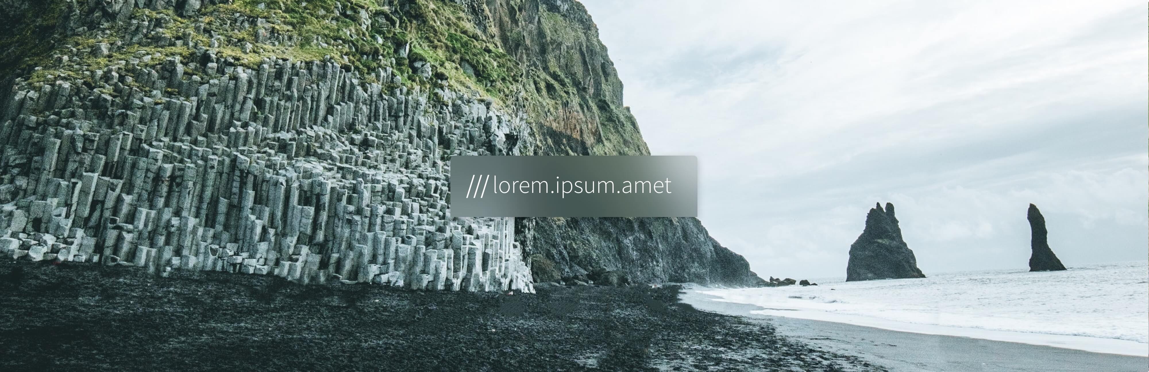
Making the place a photo was taken visible in the photo itself.
3WordPhoto extended what3words’ 3-metre addressing system into photography, allowing users to capture or import photos, refine their location, and embed a customizable three-word address label. The app supported personalized editing and sharing through social media, messaging apps, and links to precise what3words locations.
- 3 m × 3 mLocation grid precisionEmbedded precise location addressing based on three-metre by three-metre squares.
- >20 languagesLanguage support coverageSupported international users across more than twenty languages.
Context
Case Study Overview
The project explored how a precise, human-readable location could become part of a photograph rather than remaining invisible metadata. The product was designed for travelers, photographers, and casual users who wanted to communicate exactly where an image was taken while retaining control over its visual style and sharing.
The Project
3WordPhoto brought what3words’ global grid of 3-metre by 3-metre squares into the photo-creation experience. Users could take a photo in the app or import one from their device, automatically generate a three-word address from GPS metadata, refine the location on a 3word map, place the address directly on the image, customize its appearance, and share the finished photo.
Challenge
Main Challenge
The core challenge was to geotag any photo with a unique three-word address, including situations where GPS data was inaccurate or unavailable. The experience also needed to display the address legibly without obscuring the image, provide customization and editing tools, and support secure, convenient sharing.
Problem & Opportunity
Traditional geotags store latitude and longitude in image metadata, but that information is invisible in the photo and can be changed after capture. Manual geotagging is slow, while sharing geotagged images can create privacy concerns. 3WordPhoto offered an opportunity to make location visible, memorable, and easier to communicate while letting users refine the exact position and decide how the information was shared.
Problem to Solve
The product needed to replace a fixed watermark-like treatment with a flexible label that users could position and resize themselves. In the Add a Label flow, users dragged and resized the three-word address over the photograph, with the final label placed above Share and REMOVE LABEL controls so it remained readable without covering important visual content.
Objectives
The objective was to make the 'where' of a photograph as easy to attach as the photograph itself, without requiring viewers to understand GPS coordinates or open a separate mapping application. The broader framing asked how a photo could help communicate what happened, where it happened, who was involved, when it happened, and why.
Main Goal
The headline goal was to keep the photograph as the emotional centerpiece while making the location system clear and legible on top of it. The Atmosphere Concept used layered blur treatments when camera chrome or interface elements overlapped the live image, and tested the same five-step journey across warm forest and cool beach imagery.
Approach
Project Approach
The project used a product-audit and task-based approach organized around five core activities: acquire, refine, label, customize, and share. Story mapping connected a Global Consumer persona to user goals, activities, task epics, and prioritized user stories, with the MVP release line defining the smallest shippable value loop.
User Testing & Research
Research examined how people share photos on social platforms and how a visual representation of precise location could be added securely. It explored location refinement as an alternative to relying solely on GPS, investigated how users understood GPS coordinates versus three-word addresses, and synthesized the findings into a story map and prioritized MVP backlog.
Solution
The solution followed five tasks: acquire an image, refine its position using a 3word map, add a generated three-word address, customize the label and image, and share the result with a link to the location. Users could choose fonts, colors, and styles, adjust brightness and contrast, crop or alter perspective, and share through social or messaging platforms.
Decisions
A movable label rather than a fixed watermark
The first treatment behaved like a watermark, with the address locked to a corner of every photo. That was simpler to build and consistent across images, but on a great many photographs the corner is exactly where the subject is. The label is the whole point of the product, so it became an object the photographer places and resizes with a two finger pinch and drag. The cost is a step: every photo now needs a placement decision before it can be shared.
Refining the square by hand, rather than trusting GPS
A photo already carries GPS coordinates, and treating them as final would have removed a screen from the main path. But GPS lands within tens of metres, and a three word address names a square three metres across, so close is simply the wrong square. Tapping the address opens a map panel that slides up and grows into a full map, and the photographer drags the pin onto the exact spot. Research put this task first, and it is also the one that costs the flow an extra screen.
Opening at 4:3, with the crop animated
The camera could have opened by asking which aspect ratio to use. Instead it opens at 4:3 and animates the crop opening and closing when a different ratio is chosen, so the change in framing happens on the live image instead of being described in a settings list. Anyone who always shoots 16:9 pays for that by changing it every time.
Blurring the overlap instead of covering it
Camera tools and the address panel sit on top of the live image. A solid bar behind them would have guaranteed contrast, but it also hides part of the frame while it is still being composed. The Atmosphere Concept blurs the image under the chrome instead, so the photograph stays visible through its own controls. Blur costs more to render, and the label needs its own contrast treatment on top of it, because a blurred background is not a predictable one.
Results
Research Outcomes
Research established that location refinement was the most important task because users needed to confirm the precise three-word square rather than blindly trust raw GPS. This finding became the Accessing the Map interaction: tapping the address expanded it, dimmed the interface, and revealed a bottom map panel that grew into a full map once dragged beyond roughly half the screen.
Learnings & Results
The app launched in December 2017. It read a photo's GPS metadata to generate the address automatically, let a photographer label an image that carried no location data at all, supported more than twenty languages, allowed the square to be refined on a map, and shared the result as a weblink, as coordinates, or as a hashtag.
A beach cleanup initiative later used it to record where hard to reach plastic pollution had been found. That is the clearest case of the label doing the job it was designed for: making a place in a photograph precise enough to go back to.
Reflection
Takeaways
User feedback showed that people wanted more creative control over three-word labels and image treatment. The product therefore needed to serve distinct audiences, including professional photographers and bloggers seeking deeper customization and younger casual users seeking a fast, playful experience. The central lesson was that a restrained visible label can make an otherwise ambiguous photograph precisely actionable.
Future Vision
3WordPhoto was integrated into the main what3words application, extending the photo-labeling concept into the core red-pin and grid-square addressing experience. Future user-testing plans focused on professional and creative users who wanted advanced customization, alongside younger audiences who wanted the experience to remain fast and fun.
Prototype
The roadmap separated an MVP from later enhancements. The MVP covered taking or choosing a photo, adding a unique three-word address, and sharing it with a location link; a Good future release added photo and label customization; and a Potential evolution introduced a tech persona that configured options before capture and a fun persona that added custom label elements.
A video prototype showed the address 'humid.foam.stray' appearing live in the viewfinder over a child playing football.
Tools & Skills
End-to-end ownership from problem framing through to a shipped, updated product.
Defined the pinch-and-drag gesture for repositioning and resizing the address label on a photo.
Mapped a Global Consumer persona's goals, activities, task epics and prioritised user stories against an MVP release line.
Full screen-state mapping of onboarding, camera, addressing, customization, sharing, library and settings, including a repeat-process loop.
Font, colour, brightness, contrast, crop and perspective controls for the label and the photo.
A consolidated icon/toolbar style sheet and tap-target diagrams produced during the post-launch update pass.
Tech Stack
Resolves any 3x3 metre square on Earth to a unique three-word address: the core addressing system 3WordPhoto extends into photography.
Reads a photo's native GPS metadata to detect its location automatically.
Manual refinement by dragging a pin on a 3word map when GPS is imprecise or unavailable.
Native device camera and photo-library access for in-app capture or importing an existing photo.
UX Accessibility
The address label can be resized and moved anywhere on the picture, so it never has to sit over the part of the photograph that matters. Where camera controls overlap the live image, the interface blurs what is underneath rather than hiding it behind a solid bar, which keeps the frame visible while it is being composed. And because the location is three ordinary words, a reader does not have to interpret latitude and longitude to know where a photo was taken.
Experimentation & Rollout
The design was staged from an MVP capture-label-share flow toward richer customization and persona-specific features. After the initial launch, an update pass consolidated camera, label editing, sharing, touch feedback, neutral UI-chrome states, share-sheet layouts for Facebook, Instagram, and WhatsApp, tap-target diagrams, and a complete camera icon and toolbar style sheet.
Disclaimers
Some detail is held back under the confidentiality terms of the engagement. What is shown here is my own design work: sketches, task models, interface states, interaction specifications and the screens that shipped. Commercial performance and internal research data belong to what3words Ltd and are not published here. The views are mine and do not represent the company.
Data Protection Act 2018 and the Computer Misuse Act 1990 Fair dealing Disclaimer - Sections 29 and 30 of the Copyright, Designs and Patents Act 1988.
Key facts
- Client
- what3words
- Year
- 2018
- Role
- Lead Product Designer (UX-UI)
- Industry
- Addressing & geocoding System
- Location
- London, UK
- Location grid precision
- 3 m × 3 m
- Language support coverage
- >20 languages
What was the challenge in 3wordPhoto App?
The core challenge was to geotag any photo with a unique three-word address, including situations where GPS data was inaccurate or unavailable. The experience also needed to display the address legibly without obscuring the image, provide customization and editing tools, and support secure, convenient sharing.
What did I actually do on 3wordPhoto App?
The project used a product-audit and task-based approach organized around five core activities: acquire, refine, label, customize, and share. Story mapping connected a Global Consumer persona to user goals, activities, task epics, and prioritized user stories, with the MVP release line defining the smallest shippable value loop.
What was the outcome of 3wordPhoto App?
Research established that location refinement was the most important task because users needed to confirm the precise three-word square rather than blindly trust raw GPS. This finding became the Accessing the Map interaction: tapping the address expanded it, dimmed the interface, and revealed a bottom map panel that grew into a full map once dragged beyond roughly half the screen. Measured outcomes: Location grid precision: 3 m × 3 m; Language support coverage: >20 languages.